More


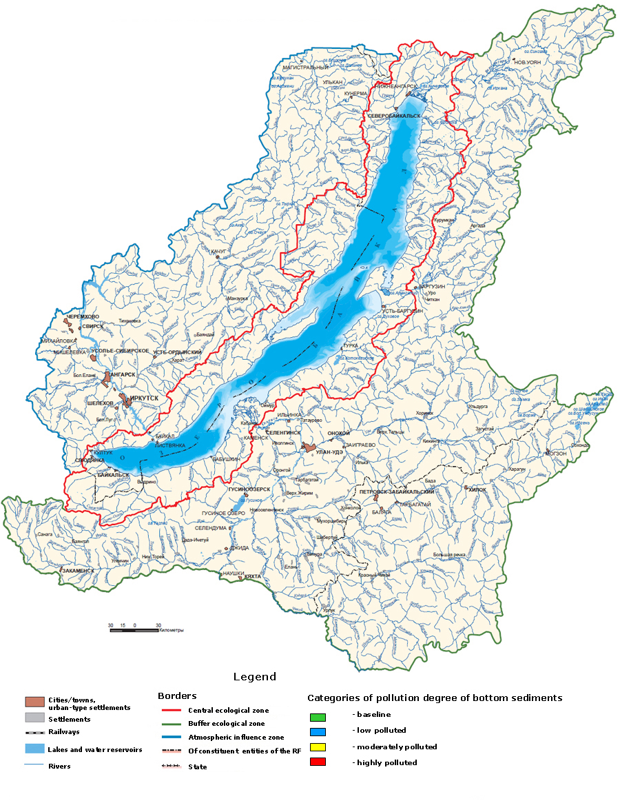
 Monitoring State environmental monitoring Monitoring of water bodies Lake Baikal Pollution of bottom sediments of Lake Baikal 2019 data
The map presents data characterizing the pollution of bottom sediments at Roshydromet landfills on Lake Baikal - in the area of influence of municipal wastewaters of the city of Baikalsk, in the shallow water of the river. Selenga and in the influence zone of the BAM route.
On the map in the area of the polygons there are pictograms in the form of the upper and lower halves of a circle. The color of the upper half of the circle corresponds to the degree of pollution of bottom sediments by benzo (a) pyrene (BP), the lower one - by the amount of polycyclic aromatic hydrocarbons (PAHs).
There are 4 categories of pollution degree - background, slightly polluted, moderately polluted and heavily polluted for PAHs and 3 categories for BP (background, moderately polluted and highly polluted).
When you hover the cursor over the icon, a window will appear with quantitative characteristics of the contamination of bottom sediments.
The graph shows the values of the area of the pollution zone of bottom sediments for 2012 - 2019, calculated by the total indicator, as the excess of the average contents of the standard ingredients for the control of bottom sediments and water in a two-centimeter layer of bottom sediments.
Geochemical changes (growth) of the main qualitative characteristics of bottom sediments and groundwater in the area of the former plant is generally associated with intra-water (hydrobiological) processes, namely, with the growth of labile organic matter in the water column of the lake, represented by phytoplankton and its further sedimentation into the bottom sediments of the lake.
In 2024, the Baikal Mile will be held from 6 to 8 June.
Taking part in the Baikal Mile is a great way to test your limits of possibilities and feel the breath of nature in one of the most beautiful places on earth.
In 2024, the festival of ice sculptures on Lake Baikal is scheduled for the period from February 15 to 28. During these two weeks, the lake shore will turn into a real open-air museum, where everyone will be able to enjoy sculptural masterpieces created from ice.


The portal has been created for FSBI ”Informational and Analytical Center for Development of Water Bodies and Associated Properties” under the special program “Protection of Lake Baikal and Socio-Economic Development of the Baikal Natural Preserve for 2012-2020.”
